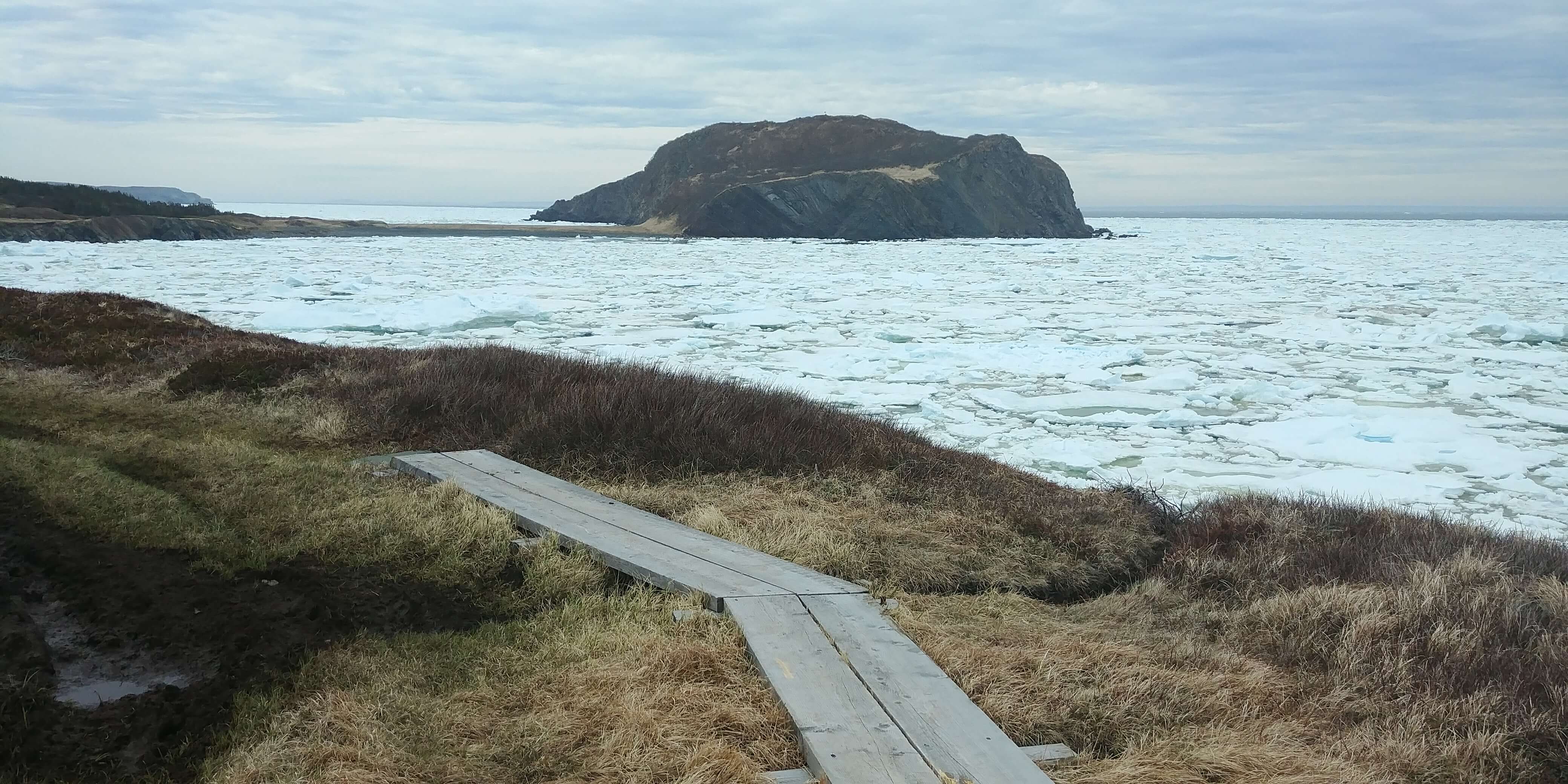
The Bonavista Peninsula is a hikers paradise. The Artisan Inn in Trinity can serve as an excellent home base for those who wish to explore the various hikes and walks along the Discovery Trail. With a variety of coastal and inland trails, rated from easy to difficult, there is something for both walkers and hikers. Spend the day hiking, return to comfortable accommodations and curl up in a blanket with a glass of wine on our front deck while resting your feet! Hand carved, wooden hiking sticks are available for Artisan Inn guests who do not wish to travel with their own.
Maps of each hiking Trail can be found on the Hike Discovery Travel App
TRINITY – UPPER & LOWER GUN HILL TRAIL
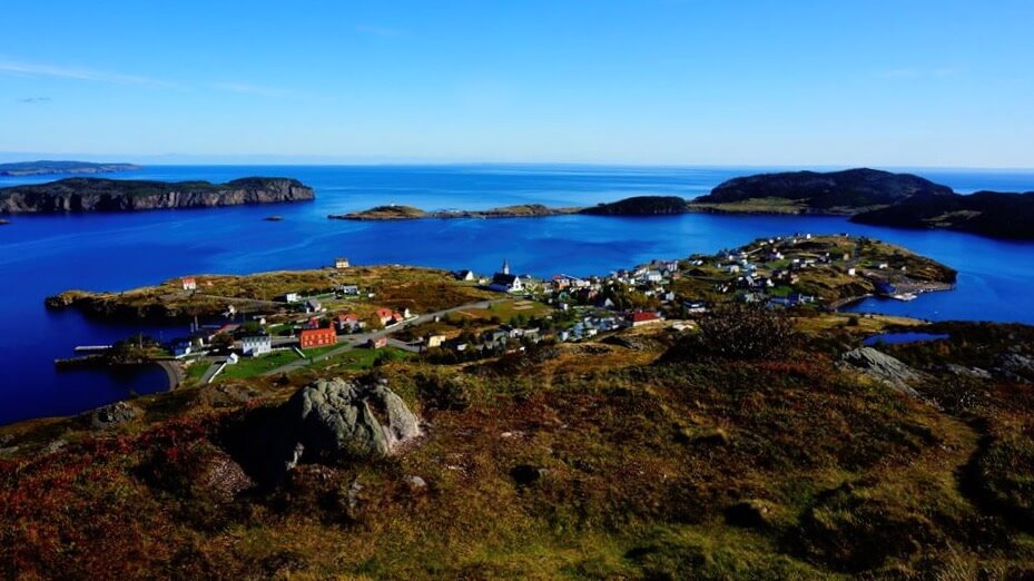
Located in Trinity, starting behind the Royal Bank or the Rising Tide Theatre
Easy (very top can be difficult)
Approx. 2 km Loop, 0.75 km to the Top, 45 Minutes – 1 Hour return
To Learn more about this trail visit the Gun Hill Page on the Explore Trinity section of our website
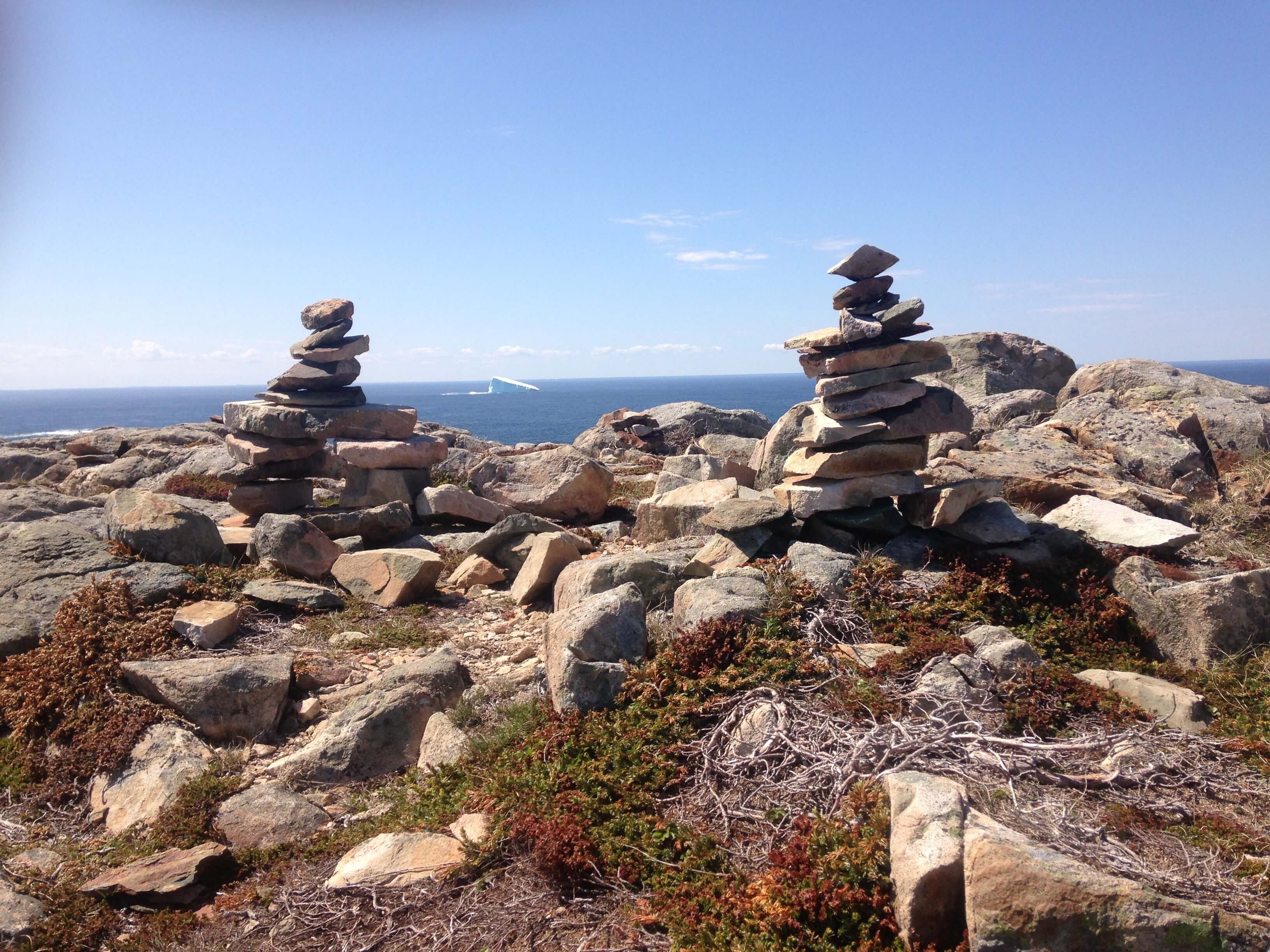
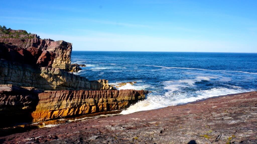
PORT REXTON – SKERWINK TRAIL
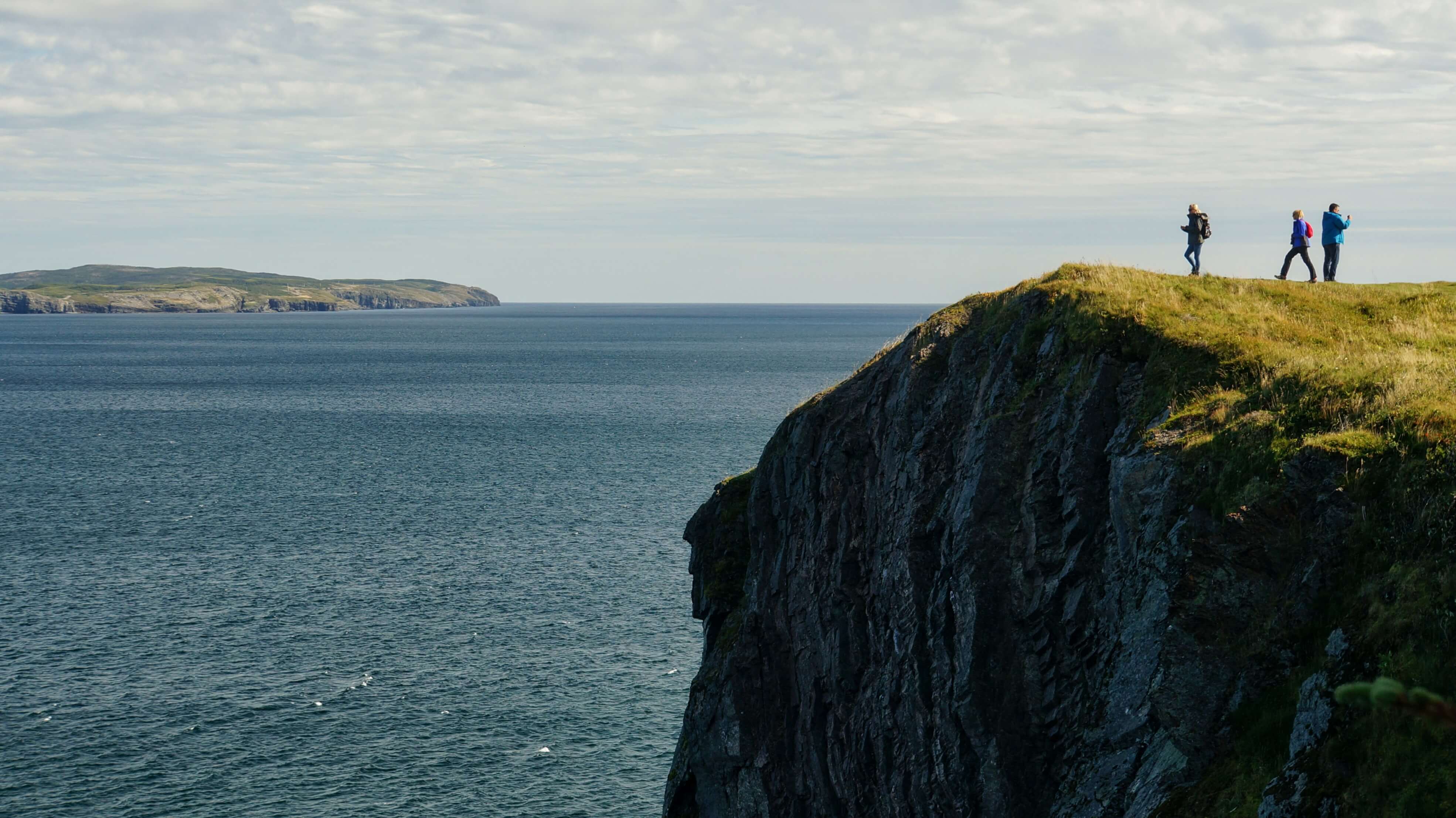
Located 10 minutes from Trinity
Moderate – Difficult
5.3 km Loop, 1.5 – 2 Hours
The Experience
Just minutes from Trinity, in Trinity East, Skerwink has been selected as one of Travel and Leisure magazine’s “25 Great Walks in North America and Europe” (May 2009).
The trail is rated Moderate and takes approximately 2 hours to complete (longer if you are passionate about photography) and is a 5.3km coastal loop. At certain locations hikers may feel as though they are standing at the edge of the world. Steeper sections of the trail have been lined with stairs and board walks cover any boggy sections. Many lookouts have been built with benches allowing visitors to stop and enjoy the view.
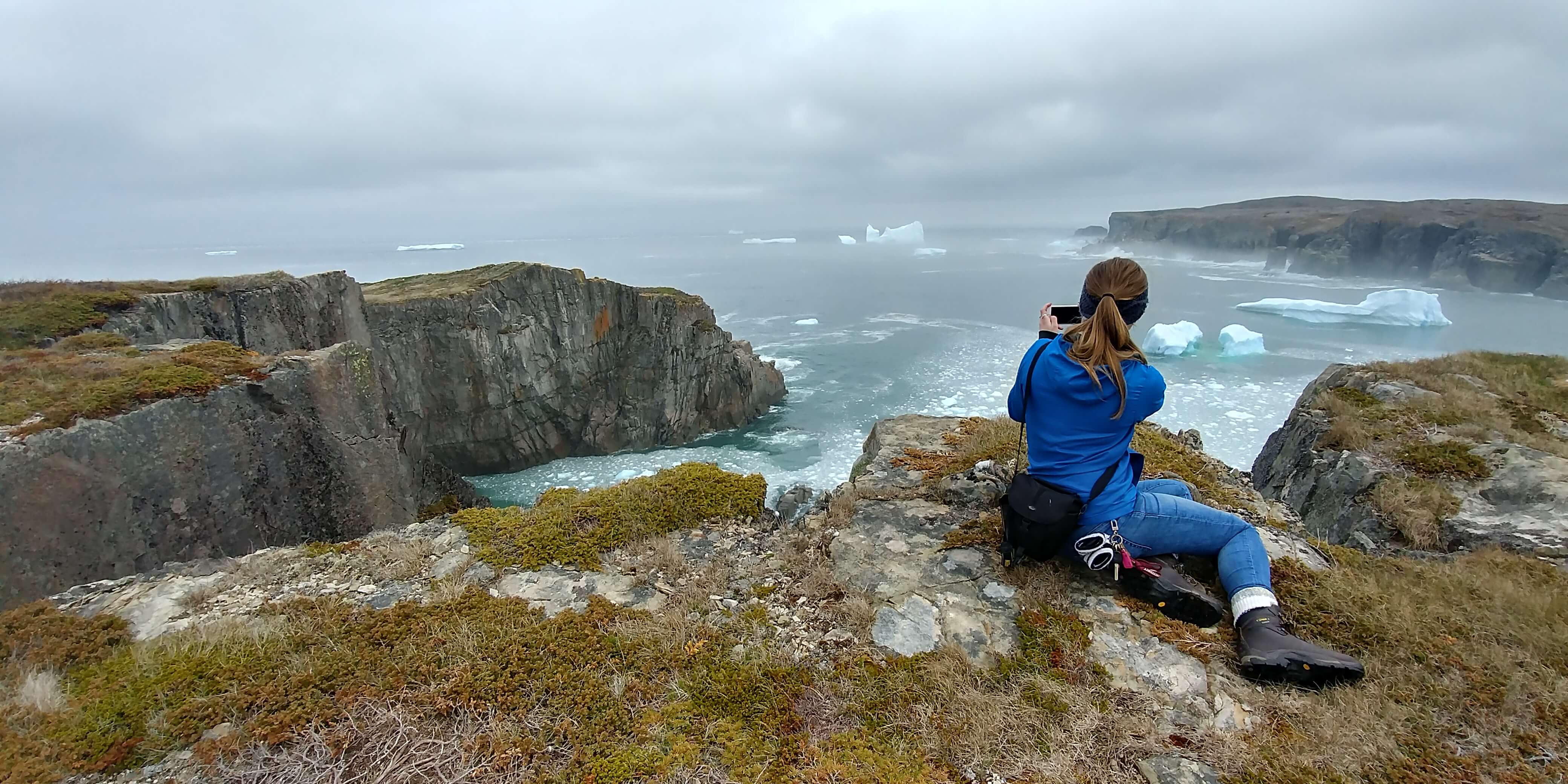
Moose, foxes, bald eagles, whales, seabirds and icebergs are often spotted.
Directions from Trinity
Leave the town of Trinity
Turn Right onto Route 239 towards Route 230
Turn Right on Route 230 towards Bonavista
Turn Right towards Trinity East after large yellow gas station in Port Rexton
Drive approx 5 minutes, pass one church, then arrive at a parking lot across from a second church. A large sign with the map of the Skerwink Trail will be to your your left.
Additional Links
Skerwink Trail: Hike Discovery Site & Map Link
In the Press: Hike Bike Travel
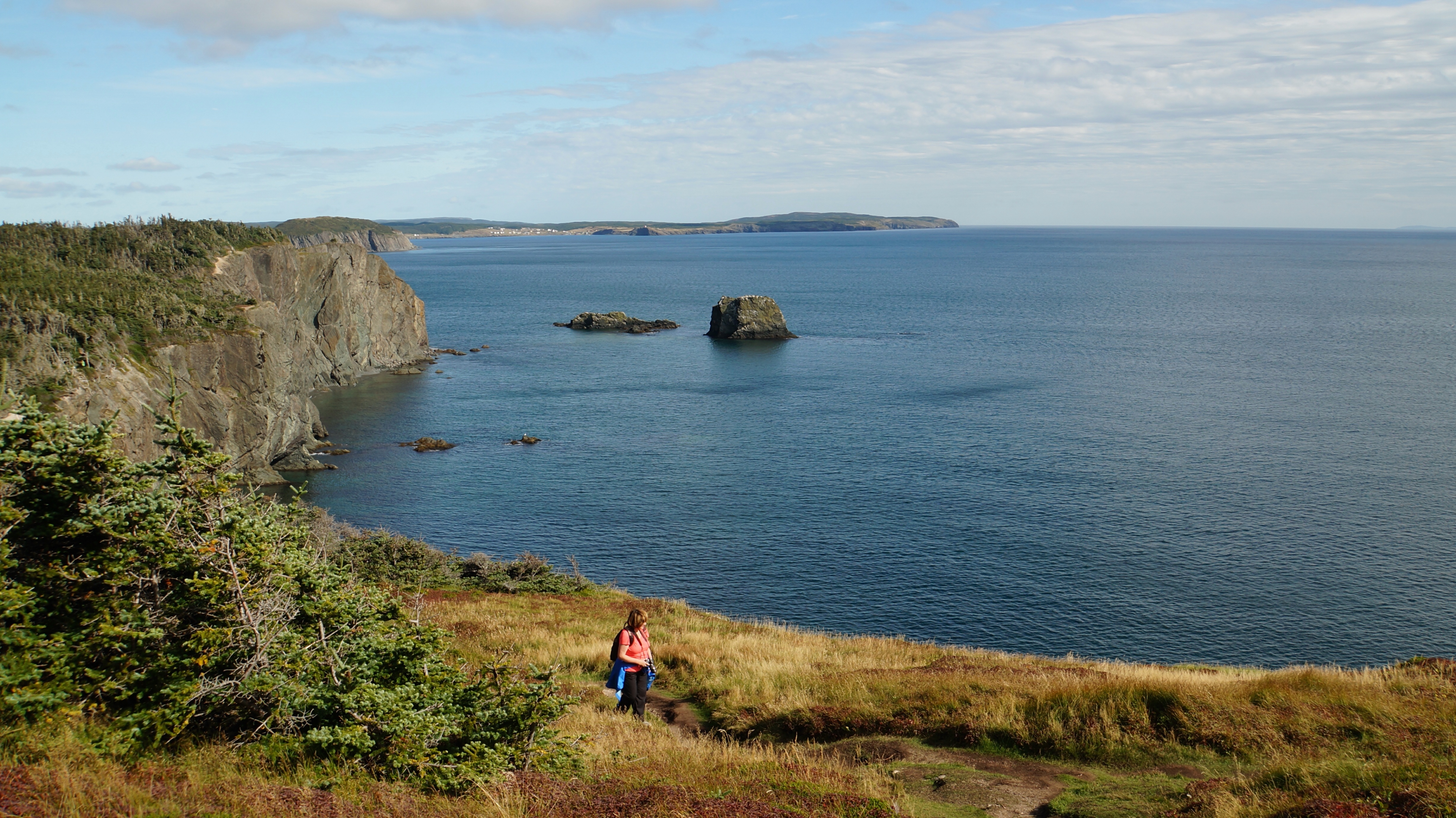
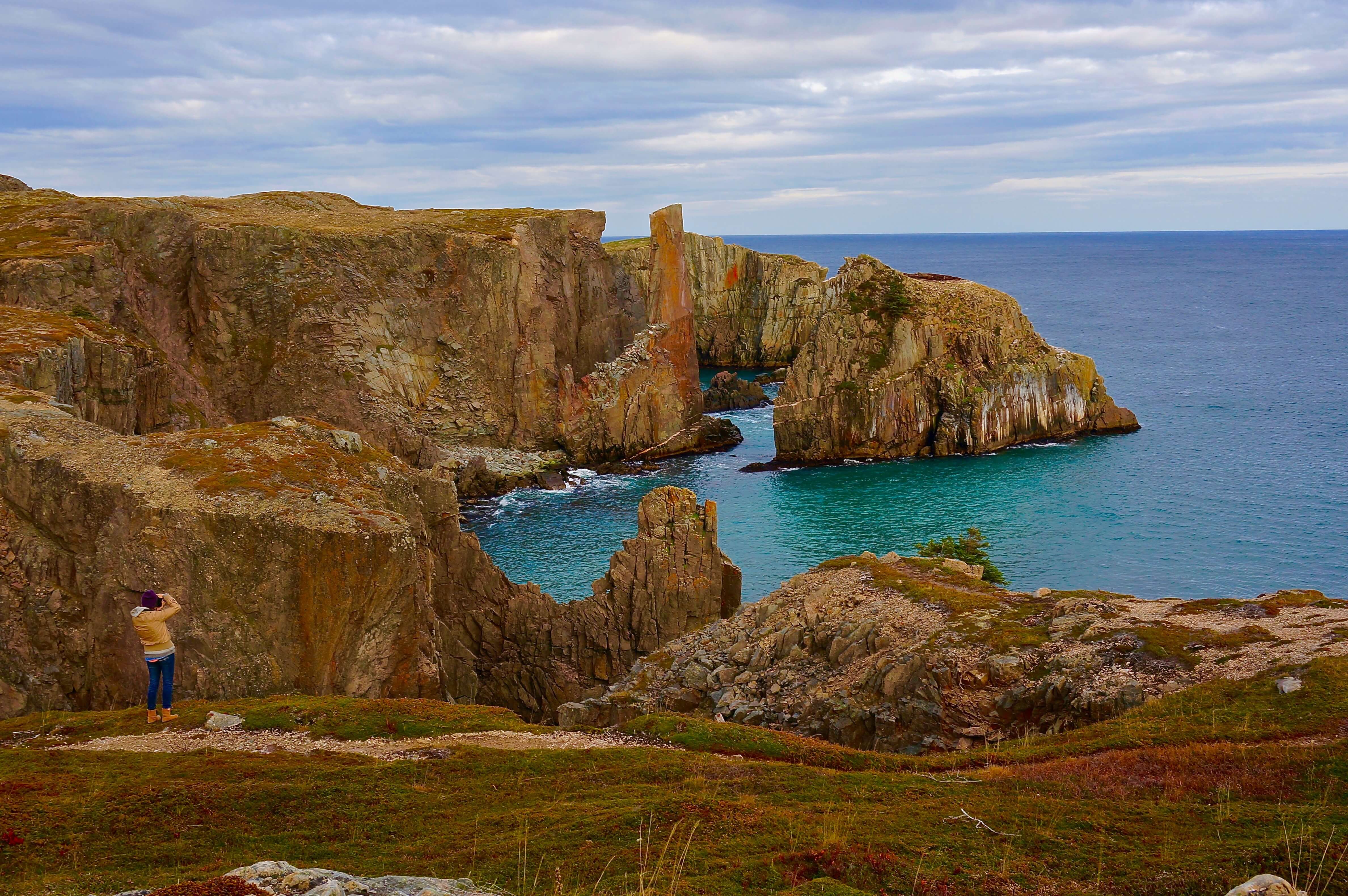
CHAMPNEY’S WEST – FOX ISLAND TRAIL
Located 15 minutes from Trinity
Easy – Moderate
5.5km Loop, Approx. 2 Hours
The Experience
The trail displays the beautiful coastal scenery, views of the surrounding communities and local wildlife, then finishes with a walk through the fishing village of Champney’s West. Take the time to walk down and view the fishing stages and maybe get your opportunity to chat to a local resident.
Directions from Trinity
Leave the town of Trinity
Turn Right onto Route 239 towards Route 230
Turn Right on Route 230 towards Bonavista
Drive past Port Rexton and turn Right onto Route 230-17 to Champney’s West
The trail parking lot is located on the right, 2km from the turn off and across from the old cemetery.
Additional Links:
Fox Island Trail: The Hike Discovery Website and Trail Maps
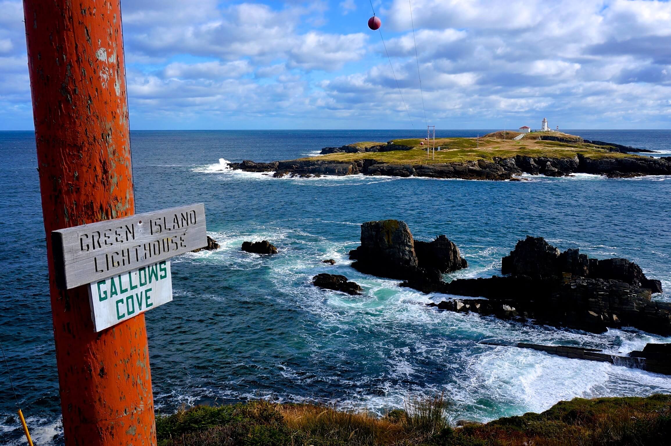
PORT UNION – MURPHY’S COVE TRAIL
Located 28 minutes from Trinity
Moderate
7.7km Loop, Approx. 3 Hours
The Experience
This coastal loop trail will take you through the abandoned community of Murphy’s Cove and overlooks the Green Island Lighthouse. This looped trail has a variety of headlands that provide viewing platforms where surrounding communities, whales, seabirds and fishing vessels can be photographed. The halfway point provides a lookout where users can view the Green Island Lighthouse, one of the last remaining manned lighthouses in the province. The trail follows the coastline offering great photo opportunities.
Directions from Trinity
Leave the town of Trinity
Turn Right onto Route 239 towards Route 230
Turn Right on Route 230 towards Bonavista
Drive 30 minutes to Port Union and turn Right onto Reid’s Road
Follow the blue hiker sign. The entrance of the Trail is located next to St Catherine’s Haven retirement home.
Additional Links
Murphy’s Cove: The Hike Discovery Website & Trail Maps
BONAVISTA – CAPE SHORE TRAIL
Located 1 Hour from Trinity
Gentle
3.5 Kilometers, Approx. 1 Hour each way
The Experience
A 3.5 km trail along the coastline that runs parallel to the main road from the Town of Bonavista to Cape Bonavista. This trail provides one with a spectacular view of Bonavista Bay as you enjoy a leisurely walk on a marked trail to the Cape Bonavista Lighthouse. Along this route you can enjoy the rugged coast line while watching for birds and whales (in season). Stop for a picnic along the trail or at the John Cabot Municipal Park.
Directions from Trinity
Leave the town of Trinity
Turn Right onto Route 239 towards Route 230
Turn Right on Route 230 towards Bonavista
Once in Bonavista, follow Confederation Drive (route 230) until you see the Right hand turn onto Cape Shore Road
Continue on Cape Shore Road until you pass the Ocean View Cabins where a parking lot will be on your right
ELLISTON / BONAVISTA – KLONDIKE TRAIL
Located 45 to 50 minutes from Trinity
Gentle – Moderate
3km, 45 minutes each way
The Experience
Located on the northern section of Elliston, it was regularly used years ago as a horse and cart trail, leading from Elliston to the community of Spillar’s Cove. This walk takes you from forest to wetlands, heathlands to sea. Learn about the plants and animals inhabiting our area while looking for our provincial bird, the puffin. You may also see whales, kittiwakes and other sea life as well as spectacular coastal scenery. This area was initially called Bird Island Cove and offers hikers spectacular oceanfront scenery with plenty of seabirds and wildlife along the way. – Text courtesy of Hike Discovery.
Directions from Trinity
Leave the town of Trinity
Turn Right onto Route 239 towards Route 230
Turn Right on Route 230 towards Bonavista
Spillar’s Cove end(Most of the Klondike trail is inland, so we suggest driving to the Spillar’s Cove end and exploring the northern section of the trail)
Drive to the Town of Bonavista
You will reach an intersection with a large green highway sign indicating Elliston and Spillar’s Cove to your right, Turn Right
Keep Left towards Spillar’s Cove at the intersection of Spillar’s Cove Road and Route 238 to Elliston
(You can also Turn Right onto Route 238 to Elliston, then turn Left onto Main Street in Elliston to access the Elliston end of the trail)
Drive through the village of Spillar’s Cove until you reach the end of the paved road, the trail begins here
Elliston end
Drive 35 – 40 mins on Route 230, then turn Right on Route 238 to Elliston
Turn Left at the John C. Crosbie Sealer’s Interpretation Centre in Elliston
Turn Right onto Main Street
Follow signage to the trail head
Additional Links
Klondike Trail: The Hike Discovery Website and Trail Maps
ROUTE 235 – KING’S COVE – LIGHTHOUSE TRAIL
Located 45 minutes from Trinity
Gentle – Moderate
1.7km inner loop, 3.5km outer loop, 0.5 or 1 hours
The Experience
The King’s Cove Lighthouse Trail is classed as a stacked loop. This provides the walker/hiker the option of completing the 1.7km inside loop or the 3.5km outside loop. Both trails are coastal hikes to the lighthouse. The outside loop offers the hiker additional coastal viewing into Bonavista Bay and Brook Point, then proceeds into the woods on a primitive trail leading back to the church. Returning via the inside loop, walkers/hikers have the opportunity to walk along rock foundations while admiring spectacular coastal scenery in Blackhead Bay.
The lighthouse was built in 1893, after some fifty shipwrecks occurred in Bonavista Bay. It was constructed of pre-cast iron, shipped from Birmingham, England. It was the first lighthouse in Newfoundland to be fitted with a revolving kerosene light system from Sweden and was visible from 14 nautical miles. Since it had to be lit every night and extinguished each morning, Philip Batterton was hired as a light keeper, a position held for over 62 years by the Batterton family.
– This information has been provided by the Discovery Trail Tourism Association
Directions from Trinity
Leave the town of Trinity
Turn Right onto Route 239 towards Route 230
The trail is located at the halfway mark of Route 235 and there are two ways to get there from Trinity. Either route will take approximately 45 minutes. One can:
A) Turn Left onto Route 230 towards Clarenville
Turn right onto Route 235 at South Bay
Turn Left onto Top Road
Park at the large church in King’s Cove. The trail begins there.
or
B) Turn Right onto Route 230 towards Bonavista
Turn left onto Route 237 at Catalina
Turn Left onto Route 235
Turn Right onto Top Road
Park at the large church in King’s Cove. The trail begins there.
GPS: N48 34’12 W53 19’56
We do not recommend taking the Route 236 through Lockston Path Provincial Park, as it is a dirt road with no cell phone reception
Additional Links
Lighthouse Trail: The Hike Discovery Website and Maps
ADDITIONAL INFORMATION
For more information about hiking trails in the Eastern Region consider ordering the book Hikes of Eastern Newfoundland.
https://www.amazon.com/Hikes-Eastern-Newfoundland-Mary-Smyth/dp/1927099595
The photographs on this page are by Marieke Gow and may only be used on other websites or print material with written permission from Marieke. mariekegow@yahoo.com